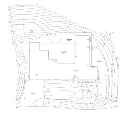
Continuing on the technological theme from yesterday’s post, another innovation that has made planning easier, less costly, and more accurate are digitally surveyed basemaps for landscape plans. We use a basemap creation service, a firm that specializes in providing elevation and base information for golf courses and landscape projects. Instead of measuring existing features such as fence lines, house footprints, etc. with a tape measure, the site is digitally surveyed using state of the art digital surveying tools and GPS equipment. A series of points are taken and then translated into a computerized drawing that pinpoints the location of existing features and elevation changes.
What this means is a product that is more accurate, less time consuming to create and much easier to use and manipulate throughout the design process. We are able to have the accuracy of a traditional surveyor, but at a fraction of the cost.
For more information on having a digital basemap created in the Marin or Sonoma County area check out MapMaking Systems, the firm out of Sonoma County that creates our basemaps.